Cemetery management plays a vital role in honoring the buried and providing comfort to their loved ones. It involves a range of responsibilities, from maintaining burial and grave ownership records to landscaping and groundskeeping.
One of the primary limitations of GPR technology is its depth penetration capability in high moisture conditions. While GPR can effectively detect objects within the first few feet beneath the ground, its efficiency diminishes as the depth increases.
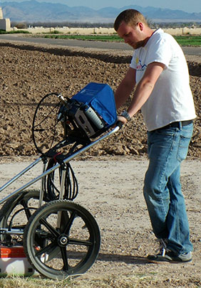
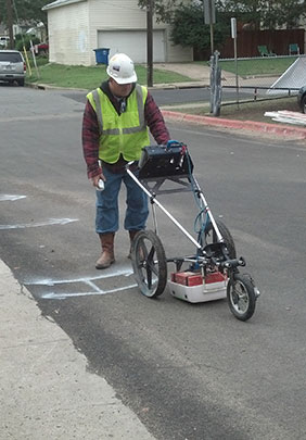
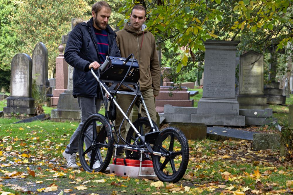
In most situations, ground penetrating radar is an excellent method for locating and identifying unmarked graves. This is especially useful in gravesite planning or even construction where the location of graves is uncertain.
Because GPR can identify soil disturbances (differences) and find buried objects, it can help researchers locate lost burial grounds and graves. For existing cemeteries, GPR can help planners in plotting new graves, especially in areas for which no burial records exist.
Transcription for headstones is the conversion of written text from a photograph of the headstone into written text to be used in record keeping. He may be placed into a file, electronic document, or uploaded into a database.
A marker may have been placed on the grave initially after burial. Depending on the material used for the market it may not last for long. Examples would be a Wooden Cross which may rot after 10+ years of the elements. During the 1800s & early 1900s, some graves were marked with a stone. If made of sandstone etchings or carving may have been on the stone. After many years of the elements, the etching have faded away, leaving a rock. Many a person mowing cemeteries have removed rogue rocks to make mowing easier, whereas in actuality they were removing a grave market. Does your cemetery have a pile of Rocks? Odds are you do. Additionally, vandals routinely damage headstones.