Utility Locating vs. DIY Methods
Below the surface of our urban jungles, lies a hidden maze of utility lines. This is the subterranean web that keeps the lights on, the water flowing, and the communication lines buzzing.
There comes a time, however, when you might need to disrupt that intricate dance. You could be excavating for a basic renovation or maybe putting up a large-scale construction project.
Whatever the case, how exactly should you conduct your utility mapping? Do you handle it all by yourself, or would a professional utility locator be more appropriate?
While DIY methods may initially entice you with their perceived cost-effectiveness, they often come with significant pitfalls. Professional utility locating services, on the other hand, are renowned for their efficiency, accuracy, safety, legal compliance, and timeliness.
To substantiate it all, we’ll review in detail what utility locating is all about, the limitations of DIY methods, the importance of accuracy in utility locating, the advanced techniques used by professionals, as well as the accompanying safety and cost considerations.
Understanding Utility Locating and DIY Methods
What is Utility Locating?
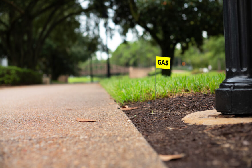
Utility locating refers to the identification and marking of subterranean utility lines, pipes, and cables. It extends to gas lines, electric lines, water and sewer pipes, as well as telecom lines for phone, cable, and internet services.
The procedure itself is usually performed before any ground-breaking activities that may interfere with the underground utilities. Otherwise, any mishaps could lead to service disruptions, property damage, personal injuries, or even fatalities.
DIY Methods for Utility Locating
While professional utility locating services use advanced equipment and techniques for accurate utility mapping, some individuals may opt for DIY methods such as visual inspection, probing, or device-assisted electromagnetic mapping.
With visual inspection, for instance, you try to find surface-level utility indicators like access covers or service connection points to buildings. That means you can only map out utilities that are visible from the surface.
At least probing is more extensive, as you’ll be using a metal rod to physically scan the ground for utilities. On the flip side, however, this method tends to be riskier since it could potentially damage utilities if done incorrectly. Other than that, it’s incapable of detecting utilities that are buried deep below the ground.
For underground utility mapping, DIYers often turn to inexpensive locator devices instead. Most of them use electromagnetic fields to detect subterranean metal pipes and cable networks. Such consumer-grade devices, though, happen to lag far behind professional utility locators in terms of calibration, accuracy, versatility, performance, reliability, build quality, and durability.
The Importance of Accuracy in Utility Locating
The precision of utility locating is critical for several reasons:
- Legal Compliance: Local laws often stipulate the need for clear identification and marking out of utility lines before any excavation work. Non-compliance could otherwise attract penalties, legal ramifications, and liabilities in the event of accidents or damages.
- Environmental Conservation: Through accurate utility mapping, we can strategically plan construction activities to circumvent environmentally sensitive areas, implement pollution prevention measures, and minimize the ecological footprint of excavation work. Any damage to underground utilities could otherwise lead to leaks, spills, and contamination of soil, water, or ecosystems.
- Service Continuity: With accurate knowledge of utility locations, contractors can plan their work to prevent accidental service interruptions affecting water, electricity, gas, telecommunications, and sewage. This reduces inconvenience to customers and surrounding communities.
- Cost and Time Efficiency: Armed with accurate information about utility locations, contractors should be able to seamlessly plan and execute their construction projects. That means fewer chances of being held up by expensive delays or redesigns. What’s more, they won’t be spending their project time on utility repairs caused by accidental damages.
- Safety: Without accurate reference points, you run the risk of accidentally damaging or rupturing utility lines. The destruction of gas pipelines or electrical cables could then cause explosions, electrocution, or fires – which may potentially harm your workers or the general public.
Professional Utility Locators
One effective way to mitigate the risk of inaccuracies in the whole mapping exercise is by leveraging professional utility locating. This is how you get to capitalize on:
Trained and Experienced Personnel
Professional locators are not just trained, they are masters in their field. They’ve been trained extensively on the diverse types of utility systems, their installation methods, and the materials used. We have insights into the characteristics of various utilities – including their conductive properties, magnetic fields, and frequency signatures.
This is the knowledge we use to accurately interpret the data from our utility locators, as well as point out potential anomalies that could compromise the accuracy of the readings. You can also count on us to distinctly differentiate between multiple utilities clustered together, separate active and inactive lines, plus generate clear utility maps.
Specialized Utility Mapping Equipment
We don’t use the same devices as DIYers. Our equipment is, instead, engineered on more advanced technologies that deliver pinpoint precision. The tools include electromagnetic locators and ground-penetrating radar (GPR), all of which can map out even deeply buried pipes, cables, and conduits.
With acoustic sensors, for instance, professional utility locators can flag underground water upon detecting the sound of the escaping water. Then when it comes to finding electrical cables, we may use something like a tracer wire detector.
Knowledge of Utility Networks
Professional locators also have direct access to official utility records and as-built drawings, from which we get valuable insight into the placement and design of underground infrastructure. The documents provide a baseline for cross-referencing all the data pulled from the advanced utility mapping equipment.
While at it, we additionally consult the utility providers who manage the specific networks. This collaboration helps us to confirm any design, modifications, or infrastructural updates that may have been left out of the documented records or drawings.
Ground Truthing
The mapping exercise isn’t all equipment-based. Rather, utility locators combine that with manual parameters through a dynamic evaluation technique known as ground truthing. We typically look for visible signs of buried infrastructure — such as utility markers, manhole covers, or valve boxes — and then use the findings to dismiss any false positives.
At times, locators may even use compact hand tools or non-destructive excavation methods to expose a section of the utility for inspection. The subsequent observations help to validate the type, depth, and placement of the utilities.
Advanced Techniques and Equipment in Professional Utility Locating
Among the range of sophisticated tools used by professionals, Ground Penetrating Radar (GPR) distinguishes itself with its unrivaled dependability in locating and mapping subterranean utilities.
Ground Penetrating Radar (GPR)
Ground Penetrating Radar (GPR) is a geophysical method that uses radar pulses to create an image of the subsurface. It sends electromagnetic waves into the ground, and then carefully scrutinizes the reflected patterns to detect variations in the underlying materials. Given its unique capacity to offer real-time and non-destructive data about the precise location of underground utilities, GPR has become a cornerstone in the field of utility detection and mapping.
How it Works
A standard GPR system is composed of a control unit — which features a radar transmitter and receiver — plus an antenna. It’s this antenna that projects short, high-frequency electromagnetic pulses into the ground.
When those pulses hit two materials with different electromagnetic properties, a portion of the energy is reflected back to the surface while the remainder continues to penetrate the substructures.
Here at Wood Inspection Services, we use GPR technology to analyze the timing and amplitude of the various forms of reflection. Time differences tell us more about the depth, position, and unique attributes of buried utilities, while the corresponding amplitude of the reflected signals reveals the properties of the subsurface materials.
All that data is ultimately converted into maps that provide a visual representation of the location and layout of underground utilities. This is what we give construction crews to help them avoid damaging underlying services during excavation.
For the sake of accuracy, though, we don’t rely on GPR alone. We always get the best results when it’s combined with other advanced utility locating techniques.
To detect underground voids and sinkholes, for instance, our experts use Ground Penetrating Technology along with Infrared Thermography.
Safety Considerations for Utility Locating
Errors in utility locating tend to increase the risk of damaging the underlying network of services. And with these damages come significant safety hazards, which will then threaten the well-being of your workers and the general public.
These risks are particularly high for DIYers, as they may not have all the knowledge or equipment required for accurately locating utilities underground.
Hazards Associated with Underground Services (Especially for DIYers)
The most common safety hazards include:
- Contact with live utility lines: Accidental contact with live utility lines – such as electrical or gas conduits – may trigger disastrous outcomes like electrocutions, explosions, or fires. Data from the Bureau of Labor Statistics suggests that electrocution is among the four leading causes of workplace fatalities in the construction sector.
- Cave-ins: We’ve seen cases of utility trenches caving in abruptly, sometimes even burying workers and equipment. Such workplace fatalities in the US add up to an average of 21 per year. You can, however, reduce the risk with shoring, sloping, or trench box systems.
- Environmental pollution: Any damages to supply conduits during utility locating could discharge large volumes of water, potentially causing flooding or erosion. Excavation work, on the other hand, may expose the soil to contamination or harmful pollutants.
- Hazardous materials: Utility locating might reveal dangerous materials in underground storage tanks or pipelines. Interacting with such substances could then lead to chemical exposure, environmental pollution, or health complications. Chemical exposure alone accounts for 190,000 illnesses experienced by US workers annually.
Compliance with Regulations and Standards
In addition to safety considerations, there are legal requirements that you’re expected to comply with before, during, and after the whole exercise of locating utilities underground.
For contractors operating in the state of Texas, for example, you might want to familiarize yourself with the Texas Utilities Code. It stipulates, among other things, that anyone planning to excavate or demolish a site must notify a registered notification center before beginning their work.
You should also follow the damage prevention programs laid out by the Pipeline and Hazardous Materials Safety Administration (PHMSA). The provisions here will help you to manage correspondence between operators and excavators, as well as accurately locate and mark underground facilities.
Another great resource is the Subsurface Investigation Methodology (SIM) Specifications, from which you can confirm the standards for utility locating equipment and methods.
Cost Considerations
To adequately weigh the costs of DIY methods against the value provided by professional services, you should consider both initial and operational parameters. While it might seem cost-effective to handle utility locating yourself, the potential risks and long-term financial implications can outweigh the initial savings.
DIY Cost vs. Value of Professional Utility Services
If you take everything into account, the final cost of DIY utility locating will not be as cheap as you may have previously assumed.
Consider, for instance, the cumulative cost of purchasing or renting utility locating equipment. If you choose to rent basic Ground Penetrating Radar (GPR) devices, you can expect to spend at least $500 a month. A purchase, on the other hand, would have you forking out anything from $14,000 to $100,000.
Professional utility locating services would save you from such capital expenses, as providers always come with their equipment. You might end up paying about $200 to $300 an hour, upon which the professionals will serve you with advanced equipment and techniques.
That said, the value of those professional services lies in the accuracy of the utility analysis and mapping. It’s this precision that’ll save you money in the long run by avoiding costly damages and repairs, mitigating hazards, and providing a framework for accurate budgeting.
So, whichever way you look at it, the value of professional utility locating services extends far beyond the initial cost.
Conclusion
Whereas DIY methods may seem cost-effective initially, a comparative analysis of the accompanying potential risks and long-term financial implications proves that professional utility locating services are more rewarding.
Professional utility locators – with their extensive knowledge and advanced techniques like Ground Penetrating Radar (GPR) — provide accurate utility mapping that minimizes risks and enhances project efficiency. They protect you from regulatory fines, service disruption, utility damages, and project liabilities, which then add up to significant cost savings over the long haul.
And that’s not all. Texas-based contractors are especially lucky as WOOD Inspection Services extends their benefits even further. They get to purchase comprehensive professional utility locating services that are tailored to their specific needs.
Get in touch with us today to learn more about this exciting partnership.