Ground Penetrating Radar (GPR) is an innovative, non-invasive geophysical method that uses radar pulses to generate detailed images of what lies beneath the surface. And while it’s applied in a wide range of fields, it’s particularly widespread in construction, archaeology, and utility locating – where it has proven to be handy in detecting and mapping subsurface structures without disturbing the terrain.
To leverage this technology, one thing you need to know is how to accurately interpret GPR results. Whether you’re trying to identify buried utilities, inspect the integrity of concrete structures, or conduct archaeological site assessments, the ability to decode GPR data can significantly enhance the efficiency and safety of your operations.
In that case, allow us to start you off with the basic tips and tricks to interpreting Ground Penetrating Radar results…
Understanding Ground Penetrating Radar (GPR)
How GPR Works
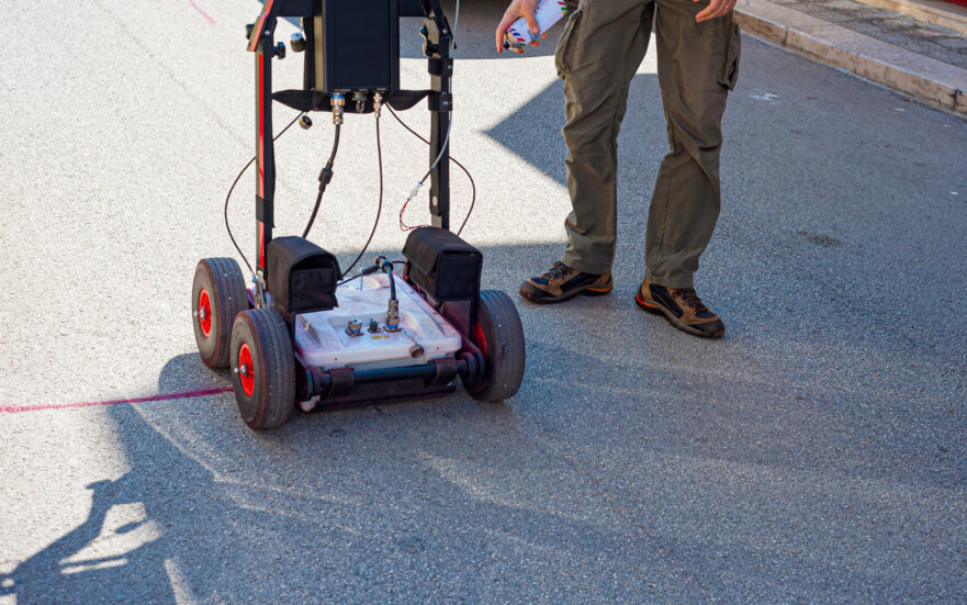
Operating under the principle of transmitting high-frequency electromagnetic waves into the ground, Ground Penetrating Radar (GPR) records reflected signals to reveal subsurface materials and objects.
The core components in this setup include a control unit, an antenna, and a display system. They’re the ones that work in unison to relay valuable Ground Penetrating Radar results.
The process itself begins when the control unit triggers a pulse of energy, which is dispatched into the ground through the antennae. Inferences are then drawn from the time it takes for the pulse to bounce back to the antenna after hitting an object or a boundary between different materials.
Such signals vary due to changes in the electrical properties of the materials below the surface. By interpreting these variations, scientists get to establish the composition, structure, and other properties of the subsurface materials.
The processed data is converted into a visual format known as a radargram. This is what offers a detailed graphical representation of the subsurface features, allowing you to identify and map any unknown substructural elements.
Another relevant set of Ground Penetrating Radar results is the time delay of the returned signal. You can use it to estimate the depth of an object or boundary below the ground.
Applications of GPR
Ground Penetrating Radar (GPR) boasts a wide range of applications, thanks to its unique ability to point out both metallic and non-metallic objects with precision.
For instance, it features quite prominently in utility locating, where it helps to detect and map the position of underground utilities like pipes and cables. You’ll find it being used extensively in urban environments, as such subsurface is often congested with utilities. GPR reduces the risk of damaging these utilities during construction or excavation projects.
Contractors additionally turn to GPR results when they need to locate and map rebar, post-tension cables, and conduits within concrete structures. GPR penetrates such building elements pretty seamlessly to offer insights that help to preserve the structural integrity of the concrete during construction or renovation projects. It would, otherwise, be a much costlier affair if contractors and engineers were restricted to the traditional methods of concrete inspection.
GPR is also leveraged in geological mapping, where it offers invaluable insights into subsurface geological features. Geologists use Ground Penetrating Radar results for void detection, as well as scanning and tracking subterranean elements like faults, bedrock, soils, etc.
Then in archaeology, GPR aids in detecting and mapping archaeological features without causing any disturbance to the site. Such non-invasive methods allow archaeologists to preserve the integrity of archaeological sites while still gaining valuable historical data about the areas.
Preparing for GPR Data Interpretation
The efficacy of your GPR technology is highly dependent on the quality of data acquisition and processing. So here are the GPR tips to follow while at it…
Data Collection and Acquisition
The integrity of the collected data directly impacts the accuracy of the subsequent interpretation. Hence, strict adherence to data collection best practices is a prerequisite if you hope to achieve reliable Ground Penetrating Radar results.
You can begin by choosing the right GPR equipment and antenna frequency based on the specific project requirements and subsurface conditions. Remember to pay special attention to the target size and depth, as well as the type of material being scanned.
Then when it comes to the actual scanning, you might want to use regularly spaced transects while closely monitoring everything and flagging any arising anomalies. This methodical approach helps to cover the survey area thoroughly, upon which you’ll be able to generate a detailed image of the subsurface.
As for the data acquisition parameters, you can set them according to the anticipated depth of the targets and the speed at which the electromagnetic waves travel through the subsurface material. This is where, for instance, you pick a time frame for recording the reflected waves – which will then determine the resolution and depth penetration of your GPR results.
Data Processing and Filtering
Once the data is collected, you’re supposed to proceed to the data processing stage. This is the phase that transforms the raw GPR data into a format that can be easily interpreted.
Consider, for instance, engaging background removal to minimize unwanted noise or reflections. GPR signals are often contaminated by ambient electromagnetic interference and electromagnetic reflections from nearby structures. Background removal mitigates the problem by mathematically subtracting the average signal response from the raw data.
You could, otherwise, try to amplify the signal-to-noise ratio with digital filters like low-pass, high-pass, band-pass, or notch. Feel free to experiment with their multiple settings until you find the best combination that’ll cut out all the noise while preserving the original GPR signal.
Time-zero correction is another critical step in GPR data processing. You’ll be required to make strategic adjustments to the data until it establishes a uniform time-zero point at the air-ground interface. Such corrections are necessary because the air-ground interface might appear at different times in your GPR data due to variations in the antenna height.
Interpreting GPR Results: Tips and Techniques
Interpreting Ground Penetrating Radar (GPR) results is an art that combines physical data verification of data with logical calculations and scientific principles.
Here’s a breakdown of what to expect:
Understanding GPR Data Displays
GPR data itself can be displayed in a myriad of formats, each offering a distinct view of the subterranean landscape. The most commonly used ones are time-slice maps, depth slices, and radargrams.
Time-slice maps and depth slices present an aerial view of the subsurface at specific depths or time intervals. That makes them perfect for highlighting lateral variations and mapping out horizontal spans of subsurface features.
Radargrams, on the other hand, offer a cross-sectional view of the subsurface. GPR signals here are represented as two-way travel time, from which you can work out the subsurface depth using the velocity of the electromagnetic waves.
Whichever display method you settle for, make sure that you know how to distinguish key features like hyperbolic reflections, diffractions, and attenuation. Hyperbolic reflections are triggered by point targets like pipes or boulders, diffractions are attributed to the edges of planar targets or subsurface inconsistencies, whereas attenuations offer clues about the electrical properties of the subsurface material.
Identifying Subsurface Targets and Features
From your Ground Penetrating Radar results, you should be able to point out common subsurface targets like pipes, cables, voids, and geological layers.
Each of them produces a characteristic signature in the GPR data. Pipes and cables, for instance, often generate hyperbolic reflections, while voids may manifest as zones of pronounced reflection succeeded by a region of signal attenuation. Geological layers are, otherwise, represented by continuous, parallel reflections.
While at it, you should keep in mind the context of your project. Plus, you might want to account for the GPR limitations, as well as the potential occurrence of false positives and negatives.
The GPR equipment may, for example, fail to capture some of the small or non-metallic targets. Another possibility would be certain subsurface conditions yielding reflections that mimic the signature of a target.
Depth Estimation and Calibration
Upon identifying subsurface targets, you should further establish their precise positions below the ground. This process is called depth estimation, and it relies on the two-way travel time of the reflected GPR signal plus the velocity of the electromagnetic waves within the subsurface material.
However, don’t proceed with the default velocity value set by the GPR system, as it might not accurately represent all the subsurface conditions. You should, instead, adjust the depth scale using verifiable ground truth data — like known utility depths or borehole information.
Such calibration methods will eliminate errors and enhance the accuracy of your depth estimates. But, remember that GPR depth estimates are only approximations and should always be treated with discretion.
Best Practices for GPR Result Interpretation
Beyond the basics of interpreting Ground Penetrating Radar results, there are several tricks that you could leverage to optimize the process even further.
The following is a breakdown of those supplementary GPR tips and best practices:
Quality Control and Cross-Validation
Quality control is all about assessing your GPR data for any discrepancies or inaccuracies. And by that, we mean checking to ensure the data collection parameters suit your project’s needs, as well as confirming that all the data processing steps have been followed accordingly.
Cross-validation is another effective tactic for refining the outcome. You basically compare your Ground Penetrating Radar results with other data sources or methodologies to verify precision. GPR results can be cross-referenced with utility records, borehole data, or findings from other geophysical explorations.
This is especially vital in complex subsurface environments where the interpretation of GPR data can be challenging. Cross-validation will not only bolsters confidence in your GPR results, but also help to pinpoint any possible uncertainties in the interpretation.
Expertise and Collaboration
Since interpreting GPR results often requires a high level of expertise and experience, you might need to seek professional assistance for some of the complex tasks.
We’d recommend that you work with seasoned GPR analysts or geophysicists. Their invaluable insights and guidance should help you avoid common pitfalls and maintain precision throughout the entire data interpretation process.
You should also try to collaborate with professionals in the subsurface analysis space. We’re talking about practitioners like engineers, utility locators, archaeologists, building contractors, etc.
Their expertise and local knowledge could prove handy in improving the interpretation of the GPR results. You also get access to their data and resources, from which you may pull credible insights for GPR calibration and cross-validation.
Conclusion
As we’ve seen, every terrain has a tale to tell and nothing decrypts that story better than a Ground Penetrating Radar.
However, while it’s indeed rewarding, interpreting GPR results is a highly challenging and technical process that requires time, field expertise, and specialized equipment.
You don’t have to go through all that trouble, though. Instead of purchasing GPR equipment worth hundreds of thousands of dollars, just use a fraction of the funds to hire a professional firm.
We’re not ones to blow our own trumpet, but no other Texas firm is as thorough and accurate as Wood Inspection Services.
The many years we’ve served as private utility locators speak for themselves. We transform Ground Penetrating Radar results into clear, actionable plans – whether you’re breaking ground for a new project, looking to preserve historical sites, or trying to maintain the integrity of existing infrastructure.
Our expert GPR analysts are just a call away. Contact us today, and we’ll provide you with an accurate GPR map of all the subsurface targets.