Ground Penetrating Radar (GPR) is a non-invasive technique that can help archaeologists uncover hidden gems under the earth. Over the course of the past few years, there have been a few remarkable ground penetrating radar discoveries made using GPR technology.
The so-called “City of the Monkey God” is one of the most amazing discoveries uncovered with GPR technology. Author Douglas Preston from the United States was part of an international team of archaeologists that used GPR to examine a distant location in Honduras in 2015. The crew came across the remnants of a long-lost metropolis that was said to have been home to the fabled White City or “City of the Monkey God.” The team mapped the location using cutting-edge GPR tools, such as a high-frequency antenna and 3D imaging technology.
There are ongoing GPR projects investigating historical cemeteries, especially ones that have unmarked graves or graves without headstones. By using surveys in ground penetrating radar archaeology, archaeologists can get a better idea of the exact locations of the graves and can even figure out the age and gender of the deceased.
Beyond the Surface: GPR News and Developments
The imaging and data analysis capabilities of GPR technology have advanced significantly in recent years. The adoption of 3D imaging software is one of the most noteworthy advancements in GPR imaging technology. With the use of this software, intricate three-dimensional models of underground buildings can be created, giving archaeologists and other researchers a thorough understanding of buried artifacts and structures.
There have also been advancements in GPR signal processing techniques. These techniques provide more precise detection, which can help locate underground objects better.
GPR technology has a wide range of potential applications in various industries, including construction, mining, environmental studies, and cemeteries.
Construction: GPR technology can map out underground utilities like pipes and cables because any excavation begins. Doing this before construction commences will prevent damage to underground infrastructure, leading to better safety measures.
Cemeteries: Locating unmarked graves is made easy through GPR technology. Conducting GPR surveys can help map out the locations of graves and potentially identify historical figures of anyone buried on site.
Mining: GPR technology can assist miners in mapping the exact location of minerals and resources. This gives mining companies a better idea of where to start the drilling and extraction process.
GPR has several advantages over other methods.
Non-invasive: GPR surveys don’t damage the ground, unlike other detection techniques like drilling or excavation, making them an excellent choice for protecting historical monuments or environmentally sensitive locations.
Depth: Compared to other methods, GPR technology has the ability to go much deeper into the earth.
Time-efficient: Researchers can quickly and thoroughly cover enormous amounts of land with GPR technology, giving them a complete picture of the objects and structures beneath the earth.
Exploring the Depths: Understanding Underground Radar Imaging
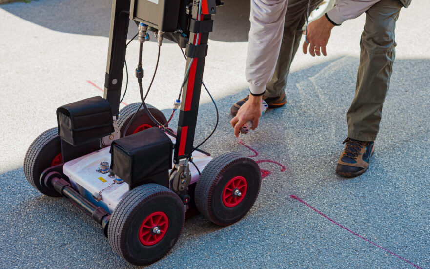
GPR is a non-intrusive geophysical survey technique that uses radar pulses to provide a picture of the subsurface. An antenna is used to send a ground penetrating radar frequency radio signal into the ground. This signal penetrates the subsurface and creates a picture of the subsurface when it encounters a change in material or density and reflects back to the surface.
The GPR system keeps track of how long the signal takes to travel into the ground before reflecting back to the surface. GPR is able to pinpoint the position, depth, and size of objects or structures that are buried by measuring the timing and intensity of the reflected signals.
Some of the more common types of GPR surveys include:
Archaeological surveys: These are used to detect buried structures and artifacts.
Geological surveys: These are used to identify rock formations and different types of soil.
Seeing the Unseen: The Advantages of GPR Surveys
GPR surveys are an environmentally non-destructive way of surveying the subsurface of the earth. The technology can be used for a wide range of applications, including cemetery mapping, construction site analysis, and utility locating. GPR surveys are beneficial for cemeteries in a number of ways.
GPR surveys can provide detailed information about the location and depth of burial plots, graves, and any buried structures or objects. This information can be used to update cemetery maps and improve the maintenance and management of the site. GPR can also be used to identify unmarked graves, which can be important for historical or legal purposes.
Generally, GPR surveys are considered to be highly accurate, with the potential to provide resolution of features down to a few centimeters in size.
FAQ
Q: Can ground penetrating radar detect bones
A: Yes, GPR can detect bones. However, the detection may depend on several factors such as the type of soil, the depth of the bones, and the frequency of the GPR equipment used.
Q: What is GPR?
A: GPR stands for ground penetrating radar. It uses radar pulses to map out images of the subsurface. You can use GPR to locate buried structures and objects without disturbing the ground.
Unveiling the Mysteries of the Past and Present with Ground Penetrating Radar
GPR technology has shed new light on our understanding of the past, and it has also become an invaluable tool for a wide range of other industries, including construction, cemeteries, mining, and environmental studies. If you’re in a business that requires subsurface investigation or are just looking for new ground penetrating radar discoveries, you should consider the many benefits of GPR technology.
GPR surveys are precise, efficient, and non-invasive, providing detailed images of buried objects without having to excavate. At Wood Inspection Services, we understand the importance of accurate subsurface investigation. With our advanced GPR technology and experienced team of specialists, we can provide detailed imaging of buried objects and structures to help you make informed decisions for your business or project.
Don’t risk costly excavation mistakes or damage to the environment. Contact us today to learn more about our GPR services and how we can help you “know what’s there before you dig.”